The Oldest Map of Europe Found Carved into Stone
 From time to time I like to feature unique stories about stone and masonry. Before pen and paper, our ancestors had to use the resources available to best record information. The most common way was carving important information into stone and stone walls.
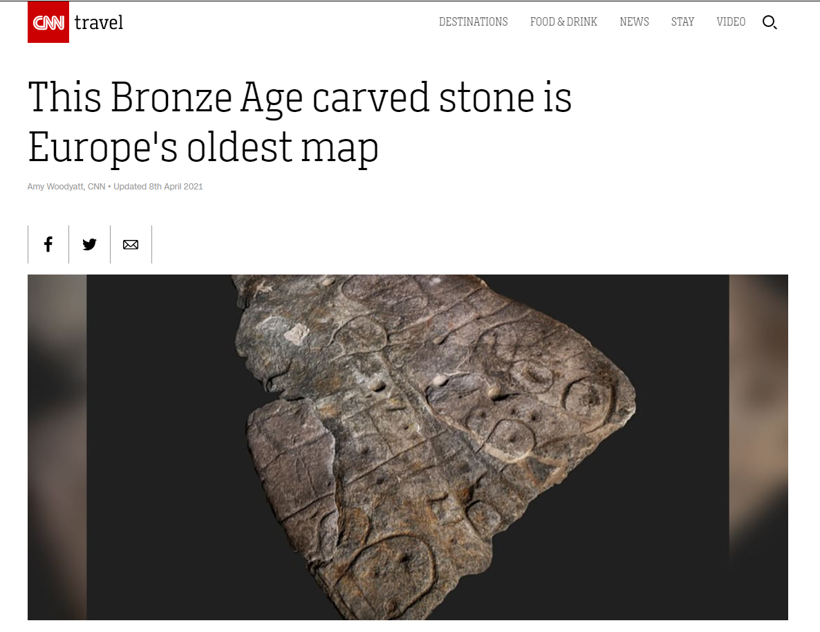
Recently, a slab of stone with engraved intricate lines and motifs dating as far back to the Bronze Age has been revealed to be Europe’s oldest map, researchers say.
As reported by CNN, researchers used high-resolution 3D surveys and photogrammetry to examine the Saint-Belec Slab – an engraved and partly broken piece of stone that was discovered in 1900 but forgotten about for almost a full century. It was revealed to be the oldest cartographic representation of a known territory in Europe.
The Oldest Map of Western Brittany
It is said that in 1900 this slab of rock was moved into a private museum, the National Museum of Archaeology, in the castle of Saint-German-en-Laye. In 2014, it was rediscovered in one of the museum’s cellars.
After studying this slab, researchers noticed that its surface was deliberately 3D-shaped to represent a valley with lines in the stone thought to depict a river network. The team of researchers noticed similarities between the engravings and landscape of Western Brittany. There are still many unknowns to this story, including why the slab was broken in the first place.
This study was published in the French Journal Bulletin de la Société préhistorique française.
It is exciting and interesting to see the different functions of stone, and how it has changed throughout centuries.